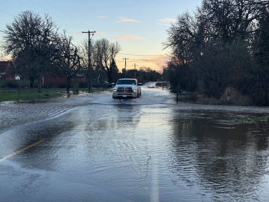
An atmospheric river that dumped record-setting amounts of rain in many western Oregon cities Thursday gave way to a mixture of sunshine and scattered showers Friday. The flooding it left in its wake was mostly of the nuisance variety, covering fields and lowlands, and temporarily closing several rural highways. Police said one person was killed Friday when they drove into a flooded area in Yamhill County.
While people in some Portland suburbs faced rising floodwaters Friday, most central and southern Willamette Valley rivers did not reach major flood stage. Still, the Oregon Department of Transportation urged drivers to use caution in the coming days.
"With all of that moisture, we still will see flooding, downed trees, possible debris on the roads, as well as possible landslides,” said ODOT spokesperson Mindy McCartt.
A flood watch from the National Weather Service remains in effect through Saturday afternoon, because some streams are expected to continue to rise as the runoff from recent heavy rain moves downhill.
“The vast majority of the heavy rainfall is passed,” NWS meteorologist Sebastian Westerink told KLCC on Friday, “but you still have the opportunity for off-and-on showers, at times you could get a quick, heavy downpour for maybe 5 or 10 minutes, and maybe a slight chance for either a rumble of thunder, potentially some small hail or graupel within them.”
Westerink said rain showers are expected to continue for the foreseeable future, but no accumulation as significant as Thursday’s is predicted.

Meanwhile, a winter weather advisory is in effect through Saturday morning for the western slopes of the Cascades, including eastern Lane and Linn Counties, but snow accumulations are expected to be in the single digits.
“It looks like Santiam Pass is going to get the most amount of snow,” he told KLCC. “I'm thinking upwards of six inches.”
A winter storm warning is in effect Friday night east of the Cascade crest, including portions of Deschutes County, where forecasts said 2 to 6 inches of snow could accumulate. The warning does not include the cities of Bend or Redmond.
Westerink said areas farther north, especially in Washington state, will have the highest snow totals from this system. He said snow is expected to slowly accumulate in the mountains into next week.
McCartt, with ODOT, said drivers headed over the mountain passes should be prepared for snow and check ahead of time for chain regulations. ODOT's website for road conditions is TripCheck.com.
“Our crews are out 24/7 statewide," McCartt said. "We’re clearing debris, clearing fallen trees, unclogging drains and culverts, responding to those floods, plowing and sanding those mountain passes.”
Power outages
Crews continued to make progress restoring power to the tens of thousands of Oregonians who lost it, either during Thursday's high wind event on the coast, or the more widespread damaging wind earlier in the week.
As of Friday at 4:30 p.m., roughly 7,500 utility customers in Oregon lacked power, according to poweroutage.us, though some of the state's smaller utilities do not feed data to that site. That's down from more than 100,00 earlier in the week.
Lane and Lincoln Counties, which earlier in the week had more than 20,000 outages combined, were down to fewer than 1,000 outages in each county on Friday afternoon.


