In a warehouse near the University of Oregon campus, Dylan Whitney is looking for materials to take on a hike. But his packing list doesn’t resemble what a person might typically bring along for a day in the great outdoors.
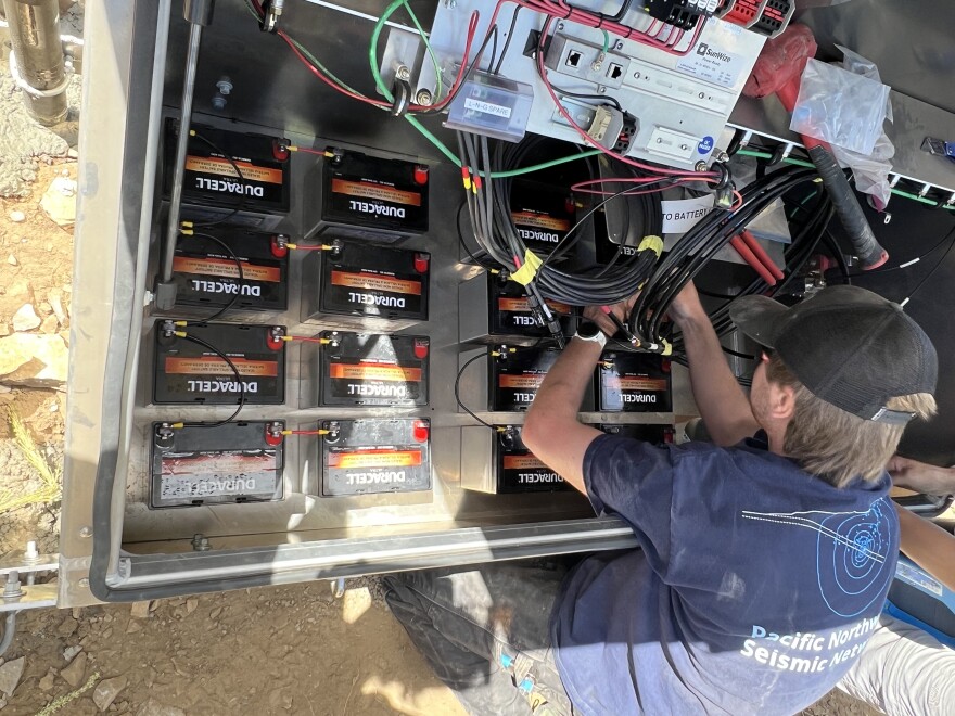
“Usually we use those deep cell large batteries,” he says, pointing at a large box on the floor. “But this time, since it's a difficult climb up to the site and we didn't want to be carrying 80 pound batteries up there, we're using a large array of small batteries.”
Whitney is a permitting and contracting specialist for the Oregon Hazards Lab at UO. On a typical work day, he’s at his desk researching potential sites for new seismic monitoring stations or filling out permit applications to start the building process.
But in the last few days, Whitney and his team of three student field technicians have visited a site at Huckleberry Mountain Lookout near Oakridge to upgrade a seismic station originally installed in 1990.
The lab, in collaboration with the University of Oregon, University of Washington and the U.S. Geological Survey, make up the Pacific Northwest Seismic Network.
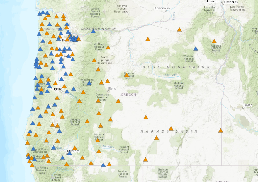
The network has more than 200 seismic monitoring stations across Oregon. These sites constantly transmit real-time data to a shared data center, where residents and researchers can access the data for free.
After a bumpy hour-and-a-half drive up to the mountain – pulling over occasionally to let logging trucks roll down the narrow dirt road – Whitney and the team unpack their trucks. They haul their gear–water jugs, bags of cement and 16 battery boxes–up a steep hill to the peak of the mountain.
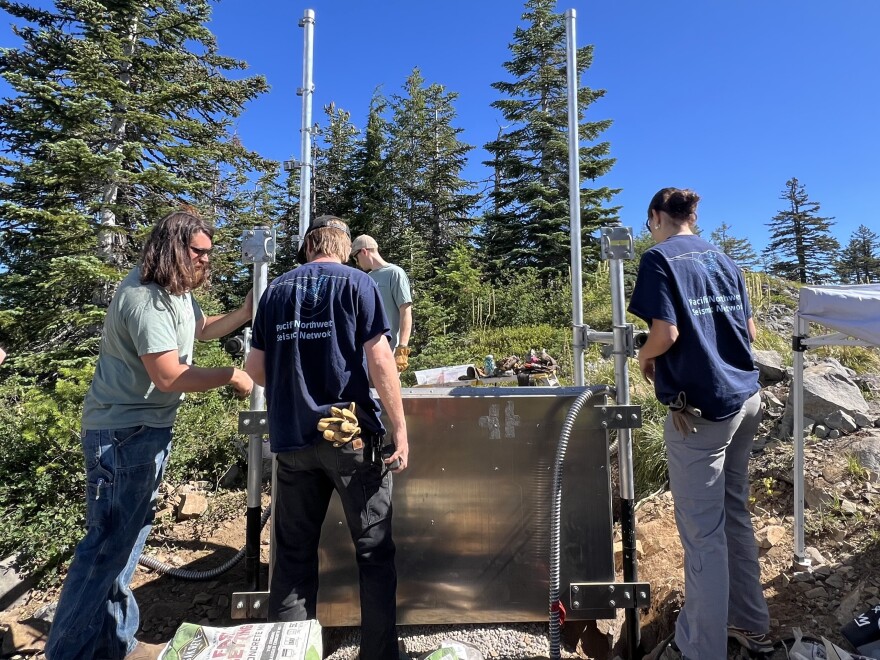
At the top, a giant aluminum box with two poles sticking out the sides sits in a pile of gravel. The crew had to jackhammer through hard rock for two days to create holes for the legs of this enclosure.

This is the power and telemetry source for the seismic sensor, equipped with batteries, solar panels and network cables. A long tube with wires connects the box to the seismic sensor, which is a few feet away.
Despite being in more than 200 different locations with varying landscapes, climates, and soil types, each sensor and power source has to be exactly the same.
“If everything works the same and you're looking at the same components every time, it's a lot easier to figure out what's gone wrong,” Whitney said.
Problem solving is a big part of the job, especially with so many moving parts. A lot of things can go wrong at the sites: network connections fail, trees grow in front of antennas, rats chew through wires, the elements can affect the structures, and much more.
That’s why the team checks up on their sites every so often, making sure power is on and the sensor is transmitting data as usual.

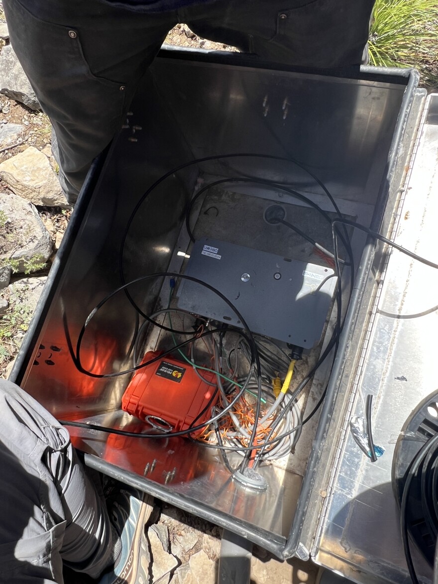
The strong-motion sensor is a small grey box tucked away in a larger aluminum box. Underground nearby is another seismic sensor–a high-sensitivity seismometer capable of recording more subtle movements in the earth.
They may not look like much, but they are extremely sensitive.
“These sensors can see you walking from dozens of meters away,” Whitney said. “Trees are noisy because they sway in the wind. We can watch the trees sway through the sensors.”
If the ground shakes miles away, the sensors help seismologists calculate the earthquake’s magnitude and location. That way, they can see where the earthquake is coming from and where it’s headed.
But some of the biggest impact from the sensors’ data comes from the network’s collaboration with the ShakeAlert Earthquake Early Warning System.
The U.S. Geological Survey-managed warning system sends out alerts about an incoming earthquake, which can give residents time to find cover and building owners time to shut off heavy machinery before the ground starts to shake.
Ben Aldrich is a senior earth science student at UO and a student field technician with the Hazards Lab. He’s seen just how helpful the alert system can be.
“It feeds into elevators, so elevators can stop, or trains in some places as well,” he said. “A couple different universities do some research with the data that comes out of the sensors as well.”
Another student field technician on site, Hayden Peabody, remembers the Cape Mendocino earthquake in California in December, which triggered alerts for Southern Oregon.
“We did hear from some schools and hospitals that they were able to pause temporarily while the shaking was happening,” he said.
For the students at the site, the hands-on experience with the sensors and the understanding of seismic data is a welcome opportunity.

Karlee Giuntoli is a business and earth science student at UO. She was initially hired to help the Oregon Hazards Lab with the business side of their operation, before becoming a field technician.
After this experience, she said, she wouldn’t be opposed to doing field work in the future.
“I wasn't always closed off to the idea,” she said, “but it's definitely enjoyable. If a future job offers that, I think I would be able to be like, ‘Hey, I actually did do field work, and it's awesome.’”
For Peabody, field work had always been a goal, but he wasn’t sure he’d have the chance to do it during school.
“This is definitely a job that I could see myself doing for a little while after graduating, and it's really great opportunity that I'm able to do this now, while I'm an undergrad,” he said.
The work is honest and challenging, but the students – and Whitney – say it’s all worth it in the end.
“It takes a lot of hard work to get to this point,” Peabody said, “even before we come to the site. Dylan does siting, and that can take –”
“Forever,” Whitney interjected.
Aldrich added that watching the development of the site brings plenty of satisfaction for the team.
“Seeing it turn from nothing there to a pit in the ground and then a mess of wires, and then seeing it all come together and go live at the end,” he said, “is pretty sweet.”
And the most rewarding part of all is that, at the end of the day, the team knows they have set up another station that can detect earthquakes early – and keep people prepared for earthquakes before they hit.


